Summer is the busy season for marine research in the waters of Western Alaska, and that means plenty of ship traffic through the Port of Nome.
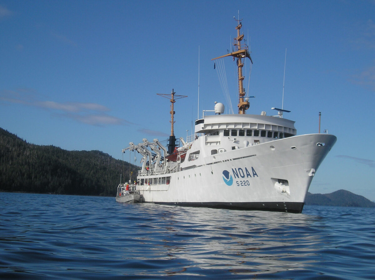
One such ship is the National Oceanic and Atmospheric Administration (NOAA) vessel Fairweather, which recently made a third stop in Nome during a mission to map the ocean floor. KNOM’s Gabe Colombo took a closer look at the people behind the operations.
Bon Jovi’s hit single blasts from the speakers aboard the Fairweather as Ensign Patrick Lawler gives me a tour of the research vessel’s main deck. It’s a cool, sunny morning in Nome’s outer harbor, where the Fairweather — named after Mount Fairweather in Glacier Bay National Park — is anchored for the weekend.
We pass a parked motorcycle beneath the ship’s massive steel crane on our way to check out the sonar equipment on board.
“A lot of people have their bikes,” Lawler says. “It’s actually pretty crucial to have some way of getting away from the boat.”
Lawler is a member of the NOAA Corps, a commissioned uniformed service whose officers lead NOAA research missions in the air, on land, and, of course, at sea. The Corps’ officers have backgrounds in a variety of scientific disciplines.
Lawler says he had been interested in joining the military until he enrolled at the Citadel Military College of South Carolina:
“I just majored in biology, and I just loved it all. And I wanted to do something similar to that, something scientific. And then I found NOAA, and I said, this is pretty perfect — I get to do it all, essentially. I grew up loving ships and boats, so driving the ship is so much fun to me.”
Along with things like driving the ship, Lawler and his colleagues are in charge of the research operations aboard the Fairweather. For the past month and a half, the ship has been mapping the ocean floor near Port Clarence in order to update nautical charts. The goal is to provide more reliable routes for ships navigating along the coast of Western Alaska.
Lieutenant Damian Manda, a NOAA Corps member from Colorado, is the operations officer on the Fairweather.
“In Port Clarence, that area is one of the few safe anchorages in this region, and in the Arctic in general, for larger deeper-draft vessels if there were to be a large storm that they didn’t want to be out in the Bering Strait for,” Manda says.
The Fairweather uses a multi-beam sonar to sweep the ocean floor for obstacles that could pose a hazard for such vessels. It turns out that technology can also be used to find missing ships, such as the fishing vessel Destination, which sunk in February without a trace. The Fairweather was able to locate the lost ship.
And, earlier in the summer, it conducted a survey of the Yukon Delta, helping to find safe navigation channels in the constantly-changing waters.
Manda says some of the charts haven’t been updated since the late 1800s:
“We’re often driving over areas on the chart that were marked as land or as no depths at all where there was no channel previously — or vice versa, where there was a channel, there was now land.”
He says it’s that sense of constant discovery that keeps him going:
“Kind of that adventure — being out here in places not too many people go. We’re definitely some of the first people to see some of the things that we do on the sea floor.”
And for the approximately 10 NOAA Corps officers and 20 civilian mariners on board, that has to keep them going for a while, since missions last for months at a time during the summer season.
But the crew also has access to a full range of amenities aboard the Fairweather, including a workout room, hot showers, and a lounge fully stocked with games, books, and movies.
In addition, the crew changes week by week, so, Manda says:
“There’s always training that’s going on, and you’re always meeting new people, and learning about their interests, so it’s always interesting to find out what their prior experiences are and find out how they ended up where we are.”
Manda’s path to the NOAA Corps began at an early age.
“I always had a love for maps and mapping, even since I was a child. I was always the navigator in the car, and that kind of thing.”
He minored in geography at the University of Colorado and later received a master’s degree in ocean engineering from the University of New Hampshire, which houses a joint research center with NOAA. He even did an internship on the Fairweather during his undergraduate studies, which motivated him to pursue the NOAA Corps.
On Saturday morning, while music blasted over the near-empty ship, Manda was off-board with some colleagues enjoying brunch at a local restaurant before heading south to continue their adventure in Kodiak.
Image at top: The NOAA Ship Fairweather in 2015. (Photo: NOAA)